We left Grande Prairie after having the van serviced and crossed into British Columbia shortly after (but we're not quite sure when since there was no welcome sign - they must have been warned we were coming).
Today's Big Stupid Thing is the beaver in Beaverlodge.
Glad we got that out of the way early in the day!
Our next find was an elk. It's farmed and not wild, but we're not choosy at this point - haven't seen much in the way of wildlife.
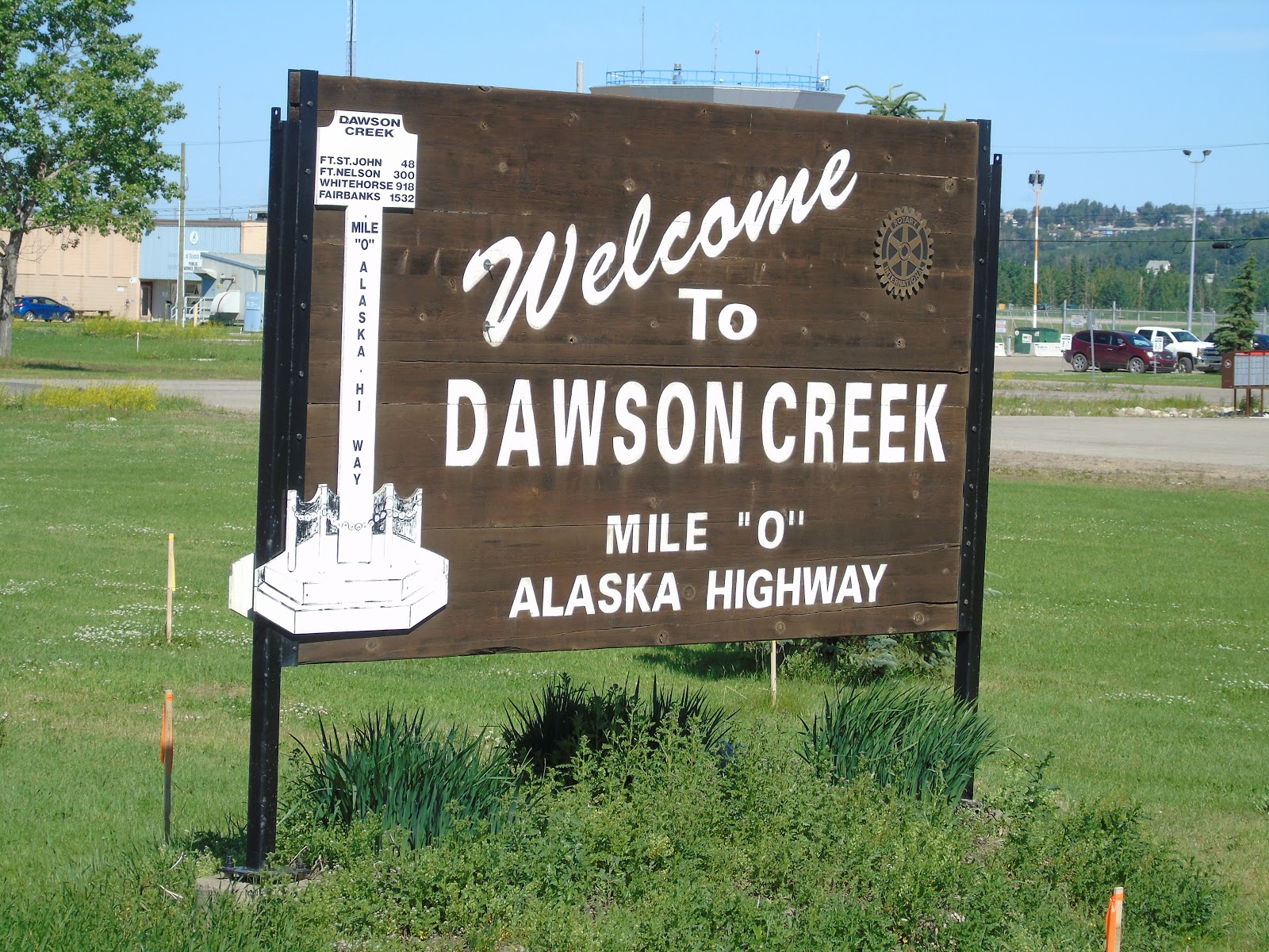
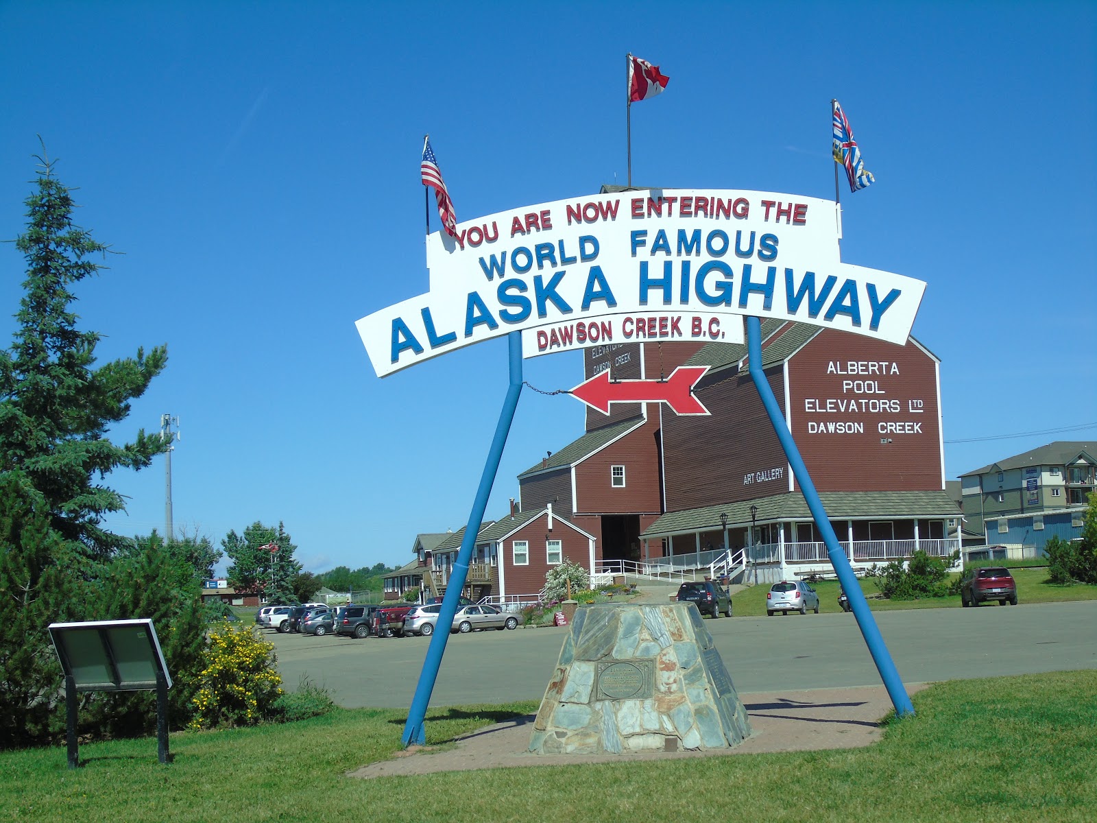
Kind of excited when we reached the start of the Alaska Highway. This is the welcome sign for Dawson Creek, but not actually mile "O". The picture below it shows the cairn at the actual beginning of the highway.
Our next stop was in Taylor, B.C. at the Visitor's Centre where Rita the travel guide took our picture.
Although we were just 18 kilometres from our destination of Fort St. John, Rita convinced us that we should get there instead by a 400 kilometre circle route. What great advice!
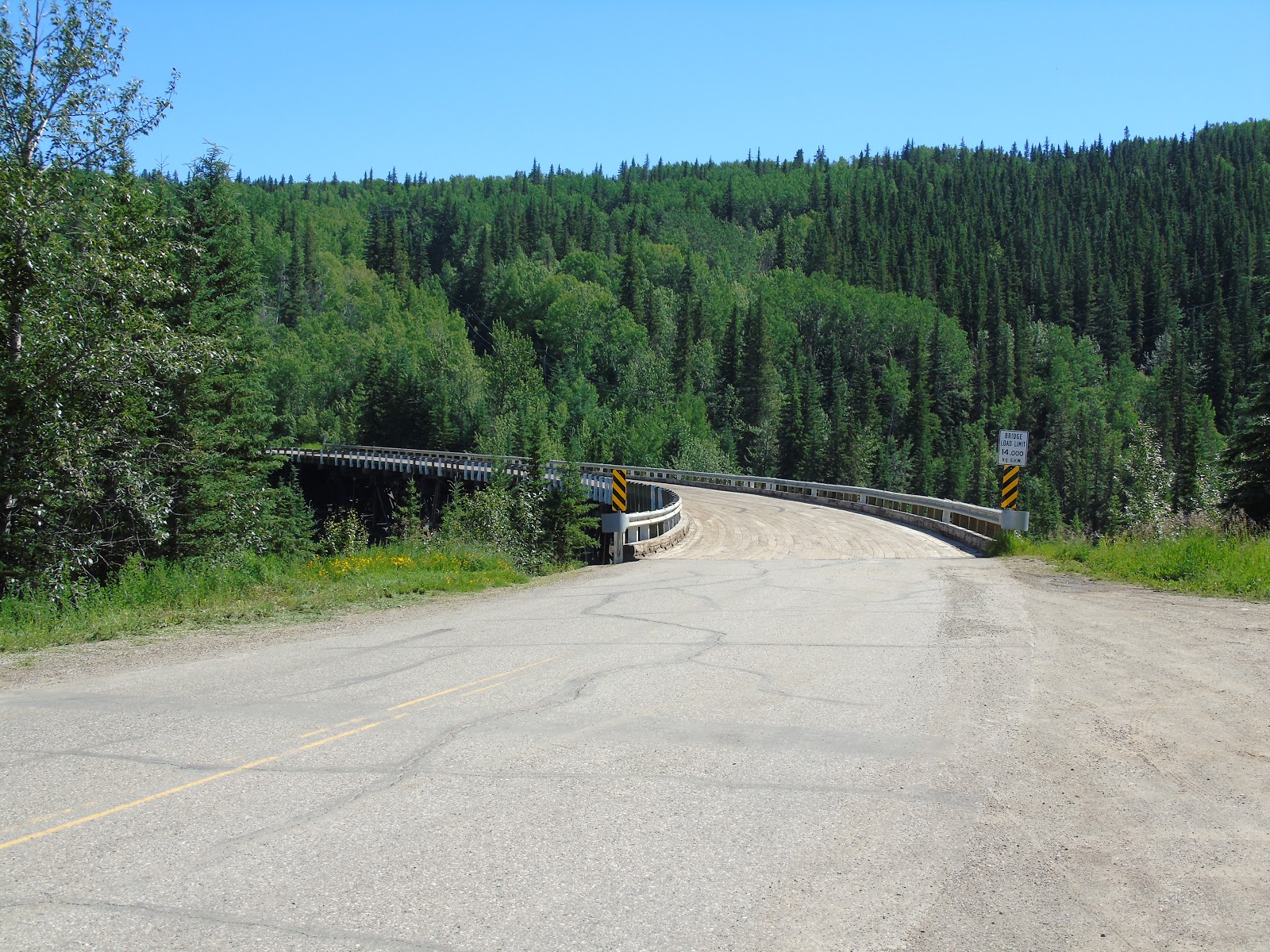
First, we retraced our route for 23 kilometres to the Kiskatinaw River. Rita pointed out that we had come across the river on a new bridge and that the old bridge was farther north and closer to the river. It is the only remaining original timber bridge on the highway. It was a work of art considering the frantic rush to complete the highway in 1942!
We then entered the Tumbler Ridge Global Geopark. Pictures don't do the area justice. It can best be described as like driving in Yellowstone Park, without the thermal features.
The Town of Tumbler Ridge has a dinosaur centre displaying the raptors, their tracks and other fossils that have been discovered in the area. Small facility but well done.

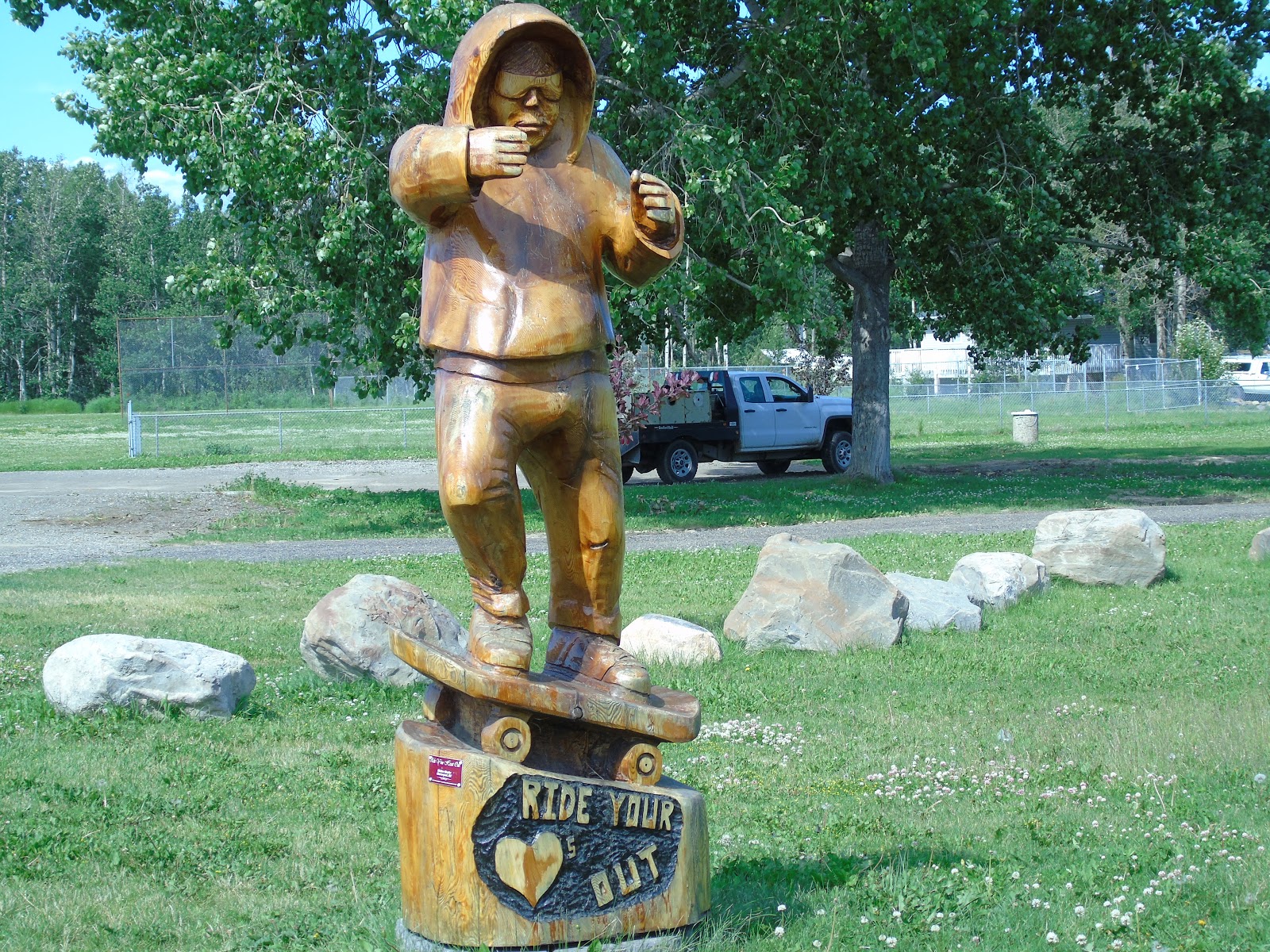
Our next stop was Chetwynd, where a local artist has placed dozens of his carvings along the town's streets.
Our final hour of the circle route followed the valley of the Peace River.
An absolutely awesome day, thanks to Rita!
Have lots more pictures which could have been included but we're dealing with "no speed" internet tonight and I'm in my second hour of inputting so it's time to say good night.
Tomorrow we head for Toad River, B.C. We're leaving Fort St. John before their Canada Day parade starts, and there's only one significant town between here and Toad River (which is a one toad hamlet so to speak) so our celebration of Canada's birthday may be muted. We'll have to see. Enjoy your day everyone!
We had a dreary, drizzly 10C start to the day, so we didn't check out the South Saskatchewan River section of downtown Saskatoon. But we did come across the river again a few kilometres west of town.
Saw a couple of deer today. One young buck almost ran in front of the van, but veered away at the last minute. Couldn't get the camera out in time, but there will be more opportunities. We did, however, see a bison ranch.
Don't see as many old wooden grain elevators any more. Most of them now look like this.
Not nearly as much character, but you can't hold back progress.
It took us just 700 kilometres to traverse Saskatchewan.
The highways across the country so far have been great (other than the odd section under construction). The highway from Edmonton to Grande Prairie is four lane, divided, all the way. Awesome!
We think this is the new style oil derrick. They litter the farmland much like our wind turbines.
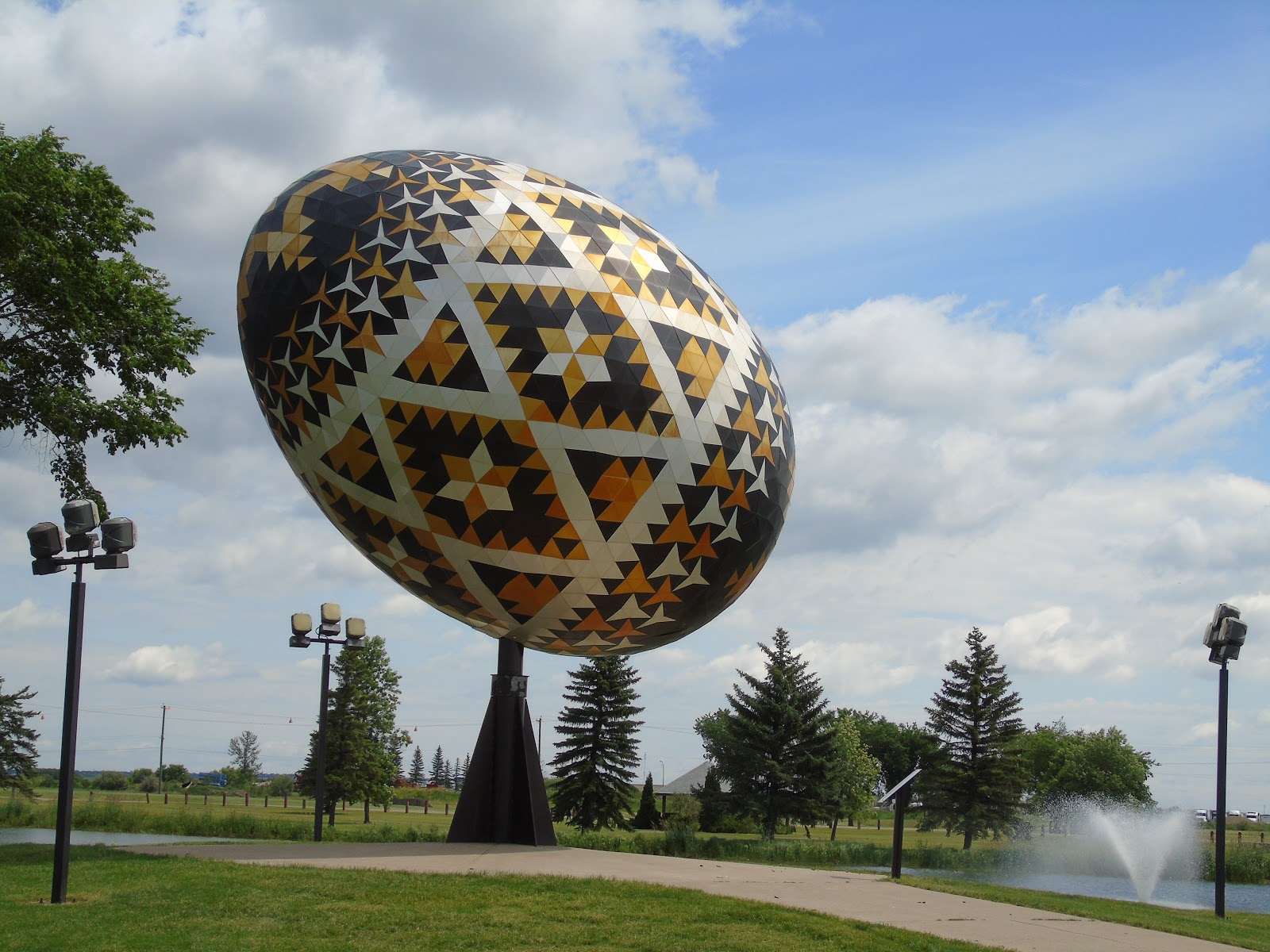
And now for our Big Thing of the day..........the Vegreville Pysanka.

As you can see, the pictures are taken from the same location. The giant Easter egg rotates a few degrees back and forth. It is made of 1108 equilateral triangles, 524 concave hexagons and other stuff - all coloured anodized aluminum. It weighs over 5,000 pounds.
It was made to coincide with the 100th anniversary of the R.C.M.P. in 1975. The computerized software to design it was the first of its kind, and was later used to design the space shuttle tiles.
We have now completed the first section of our trip, having reached the north-west limit of our previous travels. From here on it's all new and our driving pace will slow so that we can take it all in.
Tomorrow we have the van serviced and then head for Fort St. John, B.C.
When I was young (a while ago) there was no road access to Kenora and the Lake of the Woods. It was renowned as a fly-in sport fishing destination and, if I'd known about bucket lists at the time, it would have been on it.
But time goes by and priorities change. With the highway making access easier, it is no longer an exotic destination And, I am no longer concerned about catching a trophy musky. Indeed, fishing trips now are about having a beer around the campfire with good friends and sharing anecdotes from past trips. If we catch fish it's a bonus. I have probably passed through Kenora a half dozen times and haven't wet a line. But it is a beautiful place!
After 2070 kilometres we finally escaped from Ontario.
But the rain continued through the morning. We were on the Yellowhead highway west of Winnipeg and heading northwest before the sun appeared.
By the way, a litre of gas is 15 to 25 cents cheaper in Manitoba and Saskatchewan than in Ontario (of course I filled up in Ontario this morning). With all that extra tax revenue, it's incredible that Kathleen Wynne can still spend us into huge deficits!
The terrain in central Manitoba is more contoured and has more trees than the southern plains. And, amazingly, we saw lots of moose crossing signs across Manitoba and Saskatchewan despite the more open fields (just signs - no moose).
Wawa has temporarily lost its goose, but the Minnedosa Rest Area on the Yellowhead Highway has one of its own. Our only Big Thing today.
A couple of prairie homesteads.
It took us half a day and just 550 kilometres to cross our second province.
The old grain elevators are gradually disappearing, but many communities are using a combination of old and new.
And that's it for today. We had planned to walk the river downtown but a violent thunderstorm welcomed us to Saskatoon, so we're housebound tonight. Hopefully we'll get there in the morning before we leave for Grande Prairie, Alberta.
It was! Really!
Our next stop was the Terry Fox Memorial Park near Thunder Bay. We had a picnic lunch while contemplating our national hero.
It's a beautiful spot and worthy of the man and his achievement.
Mardi has been admiring the Lupines which grow along the side of the highway like weeds up here. We saw the same thing in Newfoundland. Obviously, Lupines are more content in cooler climes than the Niagara Peninsula!
We then spent a couple of hours in Dryden at Apple Auto Glass, trying to repair a crescent shaped crack in the windshield down near the cowl. Hopefully, the repair will be effective. I had anticipated a cracked windshield on this trip, but figured it would occur in the Yukon or Alaska, not in Ontario on a paved road!
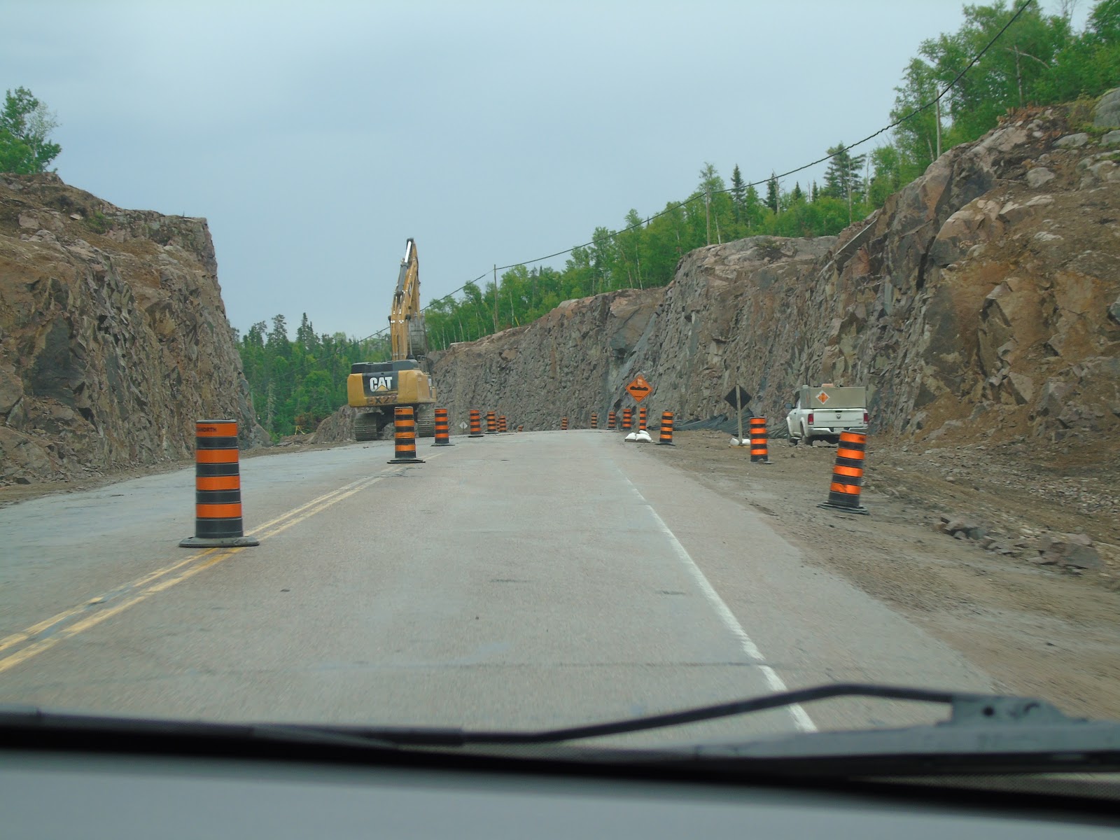
There has been lots of road construction going on as you can see from the blast site. We got our stone hit on a section which had been machine scoured and was waiting for repaving. C'est la vie!
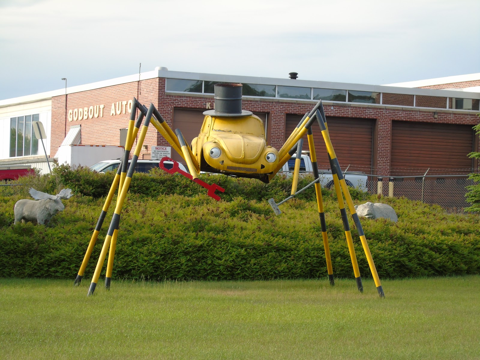
OK, it's Big Stupid Thing time.
They grow their bugs big in the north!
And their fish too.

Both the Bug and Husky the Musky live in Kenora.
Tomorrow we finally escape Ontario and head for Saskatoon.
We started our day at the Big Nickel.
The story of its origin is great - an inspiring story of entrepreneurship in the face of bureaucratic apathy. You can check it out at:
https://en.wikipedia.org/wiki/Big_Nickel
After reading that, I have decided that the Big Nickel is not stupid, but definitely a "Big Thing".
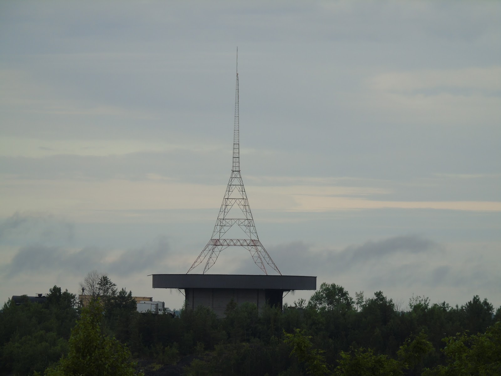
This pretend Eiffel Tower, which can be seen from the Big Nickel, is definitely in the "Big Stupid Thing" category though.
And, how about this one, found in front of Lock City Dairies in the Sault?
It rained from Sudbury to the Sault, so we don't have pictures of the north shore of Lake Huron, but the north shore of Superior, with it's Precambrian Shield and low mountains was a visual delight, as usual.
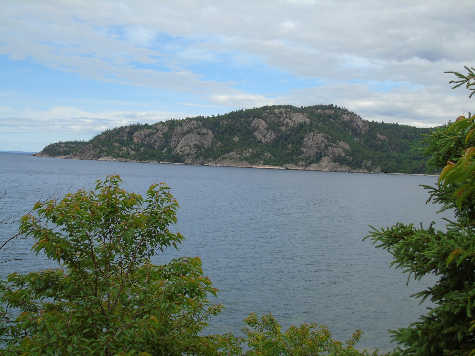
The picture above is of Alona Bay. Off the left side of the photo, and 30 kilometres out in the lake, lies the wreck of the Edmund Fitzgerald.
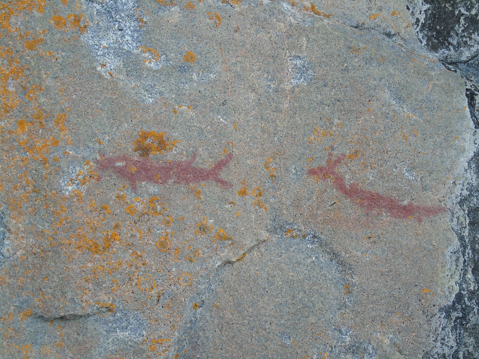
Our next stop was Agawa Rock. We hiked down a jumble of rocks to the cliff face, about half a kilometre.
 in order to see the Ojibway pictographs on the face of the rock.
Then, the return trip.
Our next stop was in Wawa. But the ultimate Big Stupid Thing has had its goose cooked! The Wawa Goose has been taken down, to be replaced by a replica done in bronze.
Three miles by gravel road took us to the Magpie River High Falls. A spectacular sight after all the recent rain!
Your hero got wet posing for that one!
Tonight we're in Terrace Bay, with a view of Lake Superior from our front window. A fantastic day, finished off with a fine Pickerel dinner (Mardi had liver and onions, yuck!). Tomorrow we head for Kenora.